
We answer 24/7
Queen Creek Water Damage Restoration, One Town Over
Queen Creek is the next town east of our south Gilbert base. From Hastings Farms and Church Farm to Encanterra and Ironwood Crossing, we pull out the water, dry what’s left and rebuild the drywall, floors and cabinets.
Request Service
Tell us what happened and we'll call you back. In a hurry? Call (623) 288-5596.
- We answer 24/7
Queen Creek, AZ
Who can do water damage restoration for a Queen Creek home?
Tri Point Services does, from our base in south Gilbert, about 6.6 road miles west of the municipal complex at 22358 S. Ellsworth Road. We extract standing water, pull wet carpet, drywall and insulation, run air movers and dehumidifiers until readings show dry, then rebuild the rooms under our KB-1 Dual Building Contractor license, ROC 335008.
Queen Creek’s houses are young. Census estimates put the median home at 2012, and about 58% of the town’s 23,569 homes went up in 2010 or later; only about 3% are older than 1980. Nine in ten are owner-occupied, and nearly all are single-family houses. The town began as Rittenhouse, a rail stop for farm produce, and incorporated on September 5, 1989. Annexing Ironwood Crossing in 2018 carried the town limits into Pinal County. The town’s water FAQ puts hardness at 6 to 17 grains per gallon and pressure between 50 and 100 psi, depending on the hour and the area, which is worth knowing when a water heater or supply line fails.
Housing: U.S. Census ACS 5-year estimates. Distance is approximate road miles.
About Queen Creek
Where does storm water cause trouble in Queen Creek?
Along the washes, the Sonoqui above all. Weather Service storm reports show Via Del Jardin closed at the Sonoqui Wash in July 2017, August 2018 and August 2021, when a county gauge near Hawes Road peaked at 7.1 feet. FEMA also maps flood zones along the Queen Creek Wash and Rittenhouse Wash branches inside town.
Wind does as much harm as water here. Storm reports logged about two miles east of the town center describe shingles stripped off houses on August 3, 2017, trees down across The Villages on September 2, 2018, and a tornado before dawn on November 29, 2019 that left roof damage and downed power poles. On July 9, 2021, a storm tore swamp coolers off buildings northeast of the town center and set off a fire sprinkler inside one. NWS Phoenix lists microbursts and flash floods among the regular hazards of its June 15 to September 30 monsoon season.
Floodplain rules come from the counties. Under ordinances the council adopted in 2025, Queen Creek stays “district dependent,” so the Flood Control District of Maricopa County manages floodplains on the Maricopa side and the Pinal County Flood Control District does it on the Pinal side. The town has been its own NFIP community, number 040132, from July 22, 1992. It doesn’t take part in FEMA’s Community Rating System, and its current map date is November 28, 2025.
About four fifths of the town’s land is in ZIP 85142 and most of the rest in 85140. The town’s GIS lists 99 residential subdivisions inside its limits, including The Villages, Hastings Farms, Church Farm, Harvest at Queen Creek, Cortina, Sossaman Estates, Encanterra, Ironwood Crossing and Pegasus Airpark, and flags 77 of them as HOA communities. The town’s tourism site leads with Schnepf Farms, the Olive Mill and Horseshoe Park & Equestrian Centre, and the 10,200-acre San Tan Mountain Regional Park lies to the south.
Permits & rebuilding
Which Queen Creek repairs need a permit?
Call Building Safety before work starts. The town says a permit application and plans must be submitted before any construction project, and that staff will tell you if your work needs one. Queen Creek builds to the 2021 International codes, in effect from January 1, 2023, and every permit runs through the online Development Nexus portal.
Before rebuilding a Queen Creek home
- Reach Queen Creek Building Safety at 480-358-3009, or Development Services at 480-358-3003. Both work from the Municipal Services Building, 22358 S. Ellsworth Road, Monday through Thursday, and close on Fridays.
- Apply, pay and book inspections in Development Nexus. The town takes permit payments only through that portal and says it never asks for wire transfers.
- Know which county your lot is in. Floodplain questions go to the Flood Control District of Maricopa County or the Pinal County Flood Control District, depending on the side of the line.
- Ask your HOA before exterior changes. The town’s GIS flags 77 of its 99 residential subdivisions as HOA communities, and Arizona law says design approval can’t be unreasonably withheld.
- File the moisture logs and photos with your claim paperwork. We document the damage and work with your adjuster, and the coverage decision belongs to your insurer.
Services in Queen Creek
What does Tri Point handle for Queen Creek households?
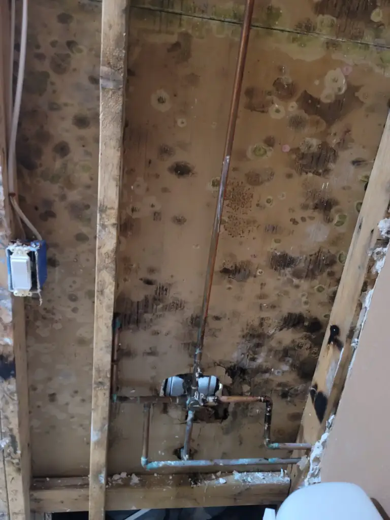
Burst and leaking supply lines, failed water heaters, washer and toilet overflows, and roof leaks after monsoon wind tears shingles loose. We do the water damage restoration and drying, flood cleanup when wash water gets inside, storm repair on roofs and walls, and mold removal when a leak sat too long.
FAQ
Queen Creek Questions
Is Queen Creek in Maricopa County or Pinal County?
Both. Most of the town is in Maricopa County, and the 2018 annexation of Ironwood Crossing carried its limits into Pinal County. The town notes that annexation never changes a property’s county. That matters after water damage, because the county decides which flood control district and which FEMA map panels cover your lot.
What is the water hardness in Queen Creek?
The town’s water FAQ puts it at 6 to 17 grains per gallon, with pressure between 50 and 100 psi depending on the time of day and the area. The 2025 water quality report shows the supply coming from 29 active wells, mixing recovered surface water and groundwater. Several other companies serve nearby areas, so check your bill to see who supplies yours.
Does Queen Creek get flood insurance discounts?
Not through FEMA’s Community Rating System, which Queen Creek doesn’t participate in, according to FEMA’s community status book. Flood insurance is still available, because the town has been an NFIP community from 1992. FEMA’s maps show Zones A, AE and AH plus shaded Zone X inside town limits.
How many miles is it from your base to Queen Creek?
About 6.6 road miles from our base on South Ramona Street in Gilbert to the municipal complex on Ellsworth Road, by the OSRM route planner, and about 5 miles in a straight line. Every project is overseen by the owner, Adam Kriloff. Ring (623) 288-5596 whenever you find water, day or night, and describe what you see.
Nearby
Which towns sit around Queen Creek?
Gilbert, home to our base, lies to the west, and Mesa borders the town to the north. San Tan Valley begins on the east side in Pinal County, and Chandler is past Gilbert to the west. Apache Junction sits to the northeast. See the full list of towns we serve.
Talk to our team
Water on the floor in Queen Creek?
Call (623) 288-5596. We’re one town over, in south Gilbert.